Our next leg was to take us from Wrightsville Beach, NC to a marina named Wacawachee in South Carolina, around mile 385.
As with all the others, this day started clear and cool, and we got underway as the sun was trying to peek over the edge of the earth.

I’m amazed at the string of excellent weather we had on this trip, with no rain days, no real clouds, some wind, but nothing too bad, and several days that encouraged the use of waffle-weave clothing.
The water in the ICW from Wrightsville Beach to the area around Masonboro Inlet where we’d come in the night before was glass-smooth, and we proceeded to take our place in what Steve called “the parade”, soon passing a hopeful sign. 
We’re about a hundred miles closer,and the sun is finally making an appearance…
This was a really pretty stretch, and there were quite a few quaint little bungalows like these along the way,
as well as a few that were a bit out of the ordinary.
Back in the early 80’s, I started designing a dome home, and seriously thought I might live in one someday. My boss at the time thought I was a bit nutty. This one looks like it is in really great shape.
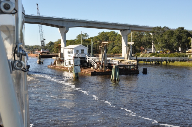
The next interesting bridge we came to was a pontoon bridge at Mile 337, just a little bit north of Sunset Beach, NC. If it isn’t the only pontoon bridge on the ICW, it is at least one of very few. It only carries one lane of traffic,
 and when boats want through, they pull a whole section out of the middle, including a little house that I guess is the bridge tenders quarters, and slide it off to the side.

The modern bridge you see right beside it will soon open and the pontoon bridge will be relegated to history. Sad for the locals who probably see it as a bit of local flavor, but boaters will enjoy the removal of one more “gotta wait for the bridge” location.
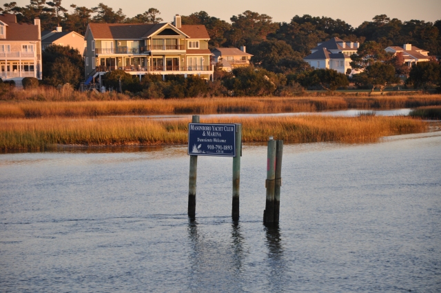
Not too far past the bridge, there is a really nice marina community.

I guess this guy didn’t want to pay the slip fees.

Steve said that it was his last delivery, but I’m not that gullible.
I think he was talking about this one…

I only saw three derelict boats during the whole trip, these three, and they were all within 200 yards of each other. Either the marina has a really strict policy for non-payment of slip fees, or these are the local equivalent of the toilet-in-the-front-yard-as-a-flower-planter.
and we entered the 20-plus mile stretch known as (insert ominous music here) “The Rockpile.” We went through here at high tide, so most of the Rockpile’s teeth were hidden just below the surface, which is actually bad in two ways. One, it doesn’t make for nearly as dramatic photos, and two, it hides the worst of it from unwary boaters who choose to ignore written warnings or posted markers.
This is the sort of rock ledge that juts into the channel.

Looks pretty straightforward in this picture, just stay away from the edge, right? The problem, according to Steve who’s been through here several times, and to the many published cruising guides, is that the ledges come much farther into the channel, and can be seen only at lower tide stages. If you assume you’re seeing it all when you look at it at high tide, you run an almost certain risk of doing very unkind things to the bottom of your boat. Fiberglass and rocks don’t play well together. In this photo, you can see how far into the channel they’ve placed one of the markers.
It’s there for a reason…stay to the right of it (going south) and you’ll miss the rocks that are just below the surface. Try to run the center of the channel, or worse, try to go around this marker on the left, and you are most likely going to come to an abrupt, noisy and expensive halt.
A little further on, and I saw what appeared at first to be a stranded UFO,
but which turned out to be a VORTAC station for the Grand Strand airport in North Myrtle Beach.

Although we couldn’t see it from the water, the charts clearly show the runway less than a quarter mile from the ICW channel. As we were poking along at 7 or 8 knots, people were zipping to and fro at hundreds of miles per hour just a stone’s throw away. Lends even more credence to my assertion that boating is a very illogical pastime.
A bit further down, there is a cable car that crosses the channel. It’s some sort of entertainment complex, but I haven’t figured out just what. The ride looks like it just goes from one side to the other, but it’s probably a pretty neat view from up there.

By this time, we’d been delayed in several spots enough that we didn’t think we could make it to Wacawachee before nightfall, so we decided to head for the next nearest marina, one called Osprey Marina.
We had to pass by a tug and barge that took up most of the channel, making for a few nervous moments as we tried to avoid the stumps lining the banks, and then we were nearing the last bridge for the night, the Socastee bridge.
OK, how would you pronounce that name…Socastee? Steve and I agreed that is was obviously So-CAS-tee, and he hailed the bridge thusly.
No answer.
Again: “So-CAS-tee bridge, this is Magic Carpet, southbound and requesting an opening.” Now keep in mind, Steve is from Massachusetts, and his speech clearly reflects that.
And also keep in mind, even though we were just a few miles from a major tourist center, for all practical purposes, there on that waterway, we were in the DEEP south, WAY back in the woods, and some folks in these parts still believe the war between the states ain’t been won yet.
A moment later came a reply just dripping with southern disdain for all things northern… “That’s SOCK-astee”.
No “Hi neighbor”, “Hey y’all”, “How ya doin’ Cap’n”, nothing.
I could almost swear I heard banjo music…
So, duly chastised, we called again, this time clearly enunciating “SOCK-astee bridge, we are the southbound motor vessel and we are requesting an opening”.
We could see that the only thing crossing the bridge was wind, but even so, we were informed that he’d open up for us in twenty minutes, when the big hand reached the six. So there we sat, pirouetting in the channel for twenty minutes while Mr. Bridge Tender finished reading an article on “How to Gut a Hog with a Sharp Stick” or some such.
Anyway, we made it through, passed a few miles further south and found the entrance channel to Osprey Marina, got tied up, refueled, and settled in for the night.
It was a nice marina, very clean, VERY quiet, and as we got ready to sleep, we really believed we’d make it to Charleston, SC the next day.


